ACROSS THE DARKNESS - Understanding the propagation, antennas and reception of the BBC Antarctic Midwinter Broadcast

ACROSS THE DARKNESSUnderstanding the propagation, antennas, and receptionof the BBC Antarctic Midwinter Broadcast
Update (6 July 2026): This article has been revised to improve the technical description of the transmitting antennas following additional research.
Another BBC Antarctic Midwinter Broadcast has come and gone. There is always great interest in the 30-minute show among members of the British Antarctic Survey at Rothera, Halley, King Edward Point, and Bird Island Research Stations. There is also a substantial audience beyond these bases, as shortwave enthusiasts worldwide tune in to the frequencies traditionally announced each year just a few days before the event.
Indeed, the signals are clearly heard by many listeners. But this doesn’t stop others from grumbling because a good signal didn’t reach their listening post. So, what should one do in a situation like this? Why, take to social media, of course, and complain bitterly! 😉
When I read these negative comments about how disappointed some people were by the poor strength and quality of the signal at their own listening locations, it says two things: 1) They have not taken into account that the transmissions are not targeted to their location, and 2) They haven’t considered some very important seasonal propagation characteristics!
Woofferton and Ascension Island
The distance from Woofferton to the largest BAS base (Rothera) is 14358 km (8922 mi). Notably, there is a continuous nighttime path between the transmitting and receiving sites at 2130 UTC, so 31- and 25-metre band frequencies should easily cover that distance.
Woofferton’s EHR(S)4/4/1.0 curtain array (HFCC antenna code 618), used for this operation on June 21, is a large, slewable broadband curtain antenna comprising four columns and four rows of horizontally polarised dipoles mounted in front of a reflector screen. Designed to handle the station’s 300 kW transmitter, it produces a high-gain, narrow beam that is well suited to the long propagation path between the UK and Antarctica.
In the station's control room, engineers use an automatic control panel linked to the 618 arrays to electronically delay or "phase" the signal. This allows engineers to shift the beam by up to 12 degrees using phase control, enabling better targeting of Rothera and the other BAS stations. For this particular broadcast, the antenna’s azimuth was set at 182 degrees. Here’s the Great Circle path that Woofferton used for this transmission.

The Woofferton - Rothera short path route.
The Ascension relay, located in the Atlantic Ocean between Africa and South America, is half as far away, at 7721 km (4798 mi). The antenna used from Ascension Island was an EHR(S)4/2/0.8 slewable curtain array (HFCC antenna code 607). Like the larger Woofferton antenna, it employs horizontally polarised dipoles mounted in front of a reflector screen, but with four columns and only two rows of dipoles. This smaller configuration provides lower gain and a somewhat broader radiation pattern, making it well suited to the considerably shorter propagation path between Ascension Island and Antarctica.
The smaller EHR(S)4/2/0.8 curtain array is likewise rated for 250 kW operation. Combined with the shorter propagation path from Ascension Island, this resulted in radiation characteristics well matched to the chosen 31-metre band frequency. The signal also travelled entirely in darkness, where nighttime ionospheric conditions favoured reliable propagation on this band.

The Ascension - Rothera short path route.
On some previous occasions, the 49- and 41-metre bands were used by Ascension and Woofferton, and sometimes by the Al Dhabbaya Transmitting Station (UAE), which are especially useful bands during low-sunspot phases of the solar cycle. However, even though we are coming off the highs of Cycle 25, which peaked around 2024–2025, solar activity remains elevated into 2026, so the 25-metre band outlet continues to perform well.
The All-Important Solstice Tilt
The June 21 solstice of 2026 (which can occur on June 20, 21, or 22, depending on the year) occurs because the Earth’s rotational axis is tilted by about 23.4° relative to the plane of its orbit around the Sun. During the June solstice, the North Pole is tilted towards the Sun, while the South Pole is tilted away. As a result, we get our longest day and shortest night of the year in the northern hemisphere, and the shortest day and longest night of the year in the southern hemisphere. The map below shows the day/night regions of the globe on June 21 at 2145 UTC.

The day/night map at 2145 UTC on June 21.
The changing Ionosphere
Woofferton is a massive multi-hop journey of roughly 14,000 kilometres, spanning almost the entire length of the globe. At 2130 UTC in late June, the sun has already set over the UK; Ascension Island is in darkness, and Antarctica is deep in its polar night. This means both radio signals travel along a 100% night-time path through the ionosphere. When this occurs, there are two major changes to the ionosphere:
1) The daytime D-layer of the ionosphere decays rapidly after sunset. During daylight hours, this layer absorbs much of the energy on the lower HF frequencies, so its absence at night allows shortwave bands to travel long distances with little signal loss.
2) After sunset, the F1 and F2 regions merge into a single F layer. Electron density gradually decreases, reducing the Maximum Usable Frequency (MUF), although the layer itself often remains at high altitude. If a station transmits at a frequency that is too high, the signal will pierce the lower electron density and pass through the ionosphere into space.
Woofferton (UK) to Rothera Research Station
At 2130 UTC, the Woofferton signal bypasses daytime absorption. However, because the entire path is in darkness, the maximum usable frequency is lower than in daylight, making frequencies around 9–12 MHz more reliable than significantly higher bands. On this occasion, the BBC split its Woofferton transmission across two separate frequencies:
👉 9460 kHz: This serves as the primary night-time frequency. At 9.4 MHz, the signal is more likely to be refracted back towards Earth by the lower-density nighttime F layer, allowing it to bounce cleanly around the Earth’s curvature.
👉 12070 kHz: Because Woofferton is in the Northern Hemisphere, where the ionosphere had been strongly ionised by daylight only a few hours earlier, the ionosphere retains residual ionisation. 12 MHz provides a higher-frequency alternative when the MUF remains sufficient.
Using two frequencies also provides frequency diversity, increasing the likelihood that at least one will propagate effectively under the prevailing ionospheric conditions.
The EHR(S)4/4/1.0 curtain array is particularly well suited to this demanding circuit. Its four-by-four dipole configuration and reflector screen produce a high-gain, highly directional beam that focuses the station’s 300 kW output toward Antarctica. This maximises the field strength arriving at the receiving area after the signal has traversed its long night-time, multi-hop path.
Ascension Island to Rothera Research Station
At just under 7800 km, this route is closer to the equator, but at 2130 UTC it is still shrouded in darkness. Because the path is entirely devoid of solar radiation, the ionospheric electron density is lower over the South Atlantic at this point in the 24-hour cycle. This year, the BBC chose 9510 kHz from Ascension Island. In complete darkness, around 9.5 MHz represented a sensible compromise between maintaining reliable F-layer refraction and avoiding the higher atmospheric and man-made noise typically encountered at lower frequencies.
The smaller EHR(S)4/2/0.8 curtain array produces a somewhat broader radiation pattern than Woofferton’s larger EHR(S)4/4/1.0 array, helping to provide reliable coverage over the intended target area.
The BBC Antarctic Broadcast Isn’t Meant for You—and That’s OK! 😊
So, where in the world won’t the signals reach?
To answer this question, we can turn to one of VOACAP’s best features: the Signal Strength Map, located at the bottom right (green button) of the VOACAP SWL web page (https://www.voacap.com/swl/). For guidance on creating a map like the ones below, see my YouTube video: HOW TO CREATE PROFESSIONAL-GRADE SHORTWAVE COVERAGE MAPS WITH VOACAP ONLINE.
Woofferton on 9460 kHz: (Click on the image for an enlarged view)

Woofferton on 12070 kHz: (Click on the image for an enlarged view)
 Ascension Island on 9510 kHz: (Click on the image for an enlarged view)

These three graphics show where signals are predicted to be strongest (warm colours) and weaker (cooler colours). The white areas indicate that reception would not be expected, or at least would be marginal. Refer to the signal strength legend on the right-hand side of the maps. On the western side of North America, listeners would find it challenging to hear the broadcast from either transmitter site, certainly not at local broadcast quality.
In fact, the maps for both transmitter sites indicate that many listeners have an excellent chance of hearing at least one, possibly two or perhaps even all three frequencies. This is especially so for Europe, the Middle East, Africa, South America, and most of Asia.
IMPORTANT NOTE: When preparing the maps, I have entered the following settings in the VOACAP Settings panel:- Receiver Antenna set to "Shortwave whip antenna" (the most basic antenna used on a portable radio)
- Noise set to “Residential” (typical urban environment)
- BC Quality set to “Standard Broadcast” (equivalent to very good)
Any changes to the above settings will result in some changes in the resultant maps e.g. say, an external dipole in a rural or remote environment.
The extent to which the maps' results may differ from your listening experience on June 21 will largely depend on:
👉 The antenna you used,👉 The noise level at your QTH, and👉 Your concept of the received signal quality – a predominantly subjective assessment! One person’s excellent signal rating may be another’s fair rating, depending on their idea of what a good shortwave signal sounds like! Of course, signal strength meters can also help here!
Final Words
If you are still reading at this point, congratulations! Thanks for sticking with me.
Finally, for listeners outside the BAS Research Stations’ target zone (the rest of the world!!), if these signals reached your location this year, that’s fantastic. If you couldn't hear the signals, or they were noisy, weak, and fluttery, just remember that you are not the target audience.
Importantly, the programme includes personal messages for BAS staff serving in Antarctica. We hope the BBC, in its generosity, will continue to provide these wonderful annual broadcasts. The BBC Antarctic Midwinter Broadcast is a shining example of the value of shortwave communication – an old technology, to be sure, but still relevant today.
Rob Wagner VK3BVW
P.S. On Google Maps, input either of the geo coordinates below to find the Rothera Research Station, and switch to the satellite view!
67°34'00.0"S 68°08'00.0"W-67.566667, -68.133333
Update (6 July 2026): This article has been revised to improve the technical description of the transmitting antennas following additional research.
Another BBC Antarctic Midwinter Broadcast has come and gone. There is always great interest in the 30-minute show among members of the British Antarctic Survey at Rothera, Halley, King Edward Point, and Bird Island Research Stations. There is also a substantial audience beyond these bases, as shortwave enthusiasts worldwide tune in to the frequencies traditionally announced each year just a few days before the event.
Indeed, the signals are clearly heard by many listeners. But this doesn’t stop others from grumbling because a good signal didn’t reach their listening post. So, what should one do in a situation like this? Why, take to social media, of course, and complain bitterly! 😉
When I read these negative comments about how disappointed some people were by the poor strength and quality of the signal at their own listening locations, it says two things:
1) They have not taken into account that the transmissions are not targeted to their location, and
2) They haven’t considered some very important seasonal propagation characteristics!
Woofferton and Ascension Island
The distance from Woofferton to the largest BAS base (Rothera) is 14358 km (8922 mi). Notably, there is a continuous nighttime path between the transmitting and receiving sites at 2130 UTC, so 31- and 25-metre band frequencies should easily cover that distance.
Woofferton’s EHR(S)4/4/1.0 curtain array (HFCC antenna code 618), used for this operation on June 21, is a large, slewable broadband curtain antenna comprising four columns and four rows of horizontally polarised dipoles mounted in front of a reflector screen. Designed to handle the station’s 300 kW transmitter, it produces a high-gain, narrow beam that is well suited to the long propagation path between the UK and Antarctica.
In the station's control room, engineers use an automatic control panel linked to the 618 arrays to electronically delay or "phase" the signal. This allows engineers to shift the beam by up to 12 degrees using phase control, enabling better targeting of Rothera and the other BAS stations. For this particular broadcast, the antenna’s azimuth was set at 182 degrees. Here’s the Great Circle path that Woofferton used for this transmission.
 |
| The Woofferton - Rothera short path route. |
The Ascension relay, located in the Atlantic Ocean between Africa and South America, is half as far away, at 7721 km (4798 mi). The antenna used from Ascension Island was an EHR(S)4/2/0.8 slewable curtain array (HFCC antenna code 607). Like the larger Woofferton antenna, it employs horizontally polarised dipoles mounted in front of a reflector screen, but with four columns and only two rows of dipoles. This smaller configuration provides lower gain and a somewhat broader radiation pattern, making it well suited to the considerably shorter propagation path between Ascension Island and Antarctica.
The smaller EHR(S)4/2/0.8 curtain array is likewise rated for 250 kW operation. Combined with the shorter propagation path from Ascension Island, this resulted in radiation characteristics well matched to the chosen 31-metre band frequency. The signal also travelled entirely in darkness, where nighttime ionospheric conditions favoured reliable propagation on this band.
 |
| The Ascension - Rothera short path route. |
On some previous occasions, the 49- and 41-metre bands were used by Ascension and Woofferton, and sometimes by the Al Dhabbaya Transmitting Station (UAE), which are especially useful bands during low-sunspot phases of the solar cycle. However, even though we are coming off the highs of Cycle 25, which peaked around 2024–2025, solar activity remains elevated into 2026, so the 25-metre band outlet continues to perform well.
The All-Important Solstice Tilt
The June 21 solstice of 2026 (which can occur on June 20, 21, or 22, depending on the year) occurs because the Earth’s rotational axis is tilted by about 23.4° relative to the plane of its orbit around the Sun. During the June solstice, the North Pole is tilted towards the Sun, while the South Pole is tilted away. As a result, we get our longest day and shortest night of the year in the northern hemisphere, and the shortest day and longest night of the year in the southern hemisphere. The map below shows the day/night regions of the globe on June 21 at 2145 UTC.
 |
| The day/night map at 2145 UTC on June 21. |
The changing Ionosphere
Woofferton is a massive multi-hop journey of roughly 14,000 kilometres, spanning almost the entire length of the globe. At 2130 UTC in late June, the sun has already set over the UK; Ascension Island is in darkness, and Antarctica is deep in its polar night. This means both radio signals travel along a 100% night-time path through the ionosphere. When this occurs, there are two major changes to the ionosphere:
1) The daytime D-layer of the ionosphere decays rapidly after sunset. During daylight hours, this layer absorbs much of the energy on the lower HF frequencies, so its absence at night allows shortwave bands to travel long distances with little signal loss.
2) After sunset, the F1 and F2 regions merge into a single F layer. Electron density gradually decreases, reducing the Maximum Usable Frequency (MUF), although the layer itself often remains at high altitude. If a station transmits at a frequency that is too high, the signal will pierce the lower electron density and pass through the ionosphere into space.
Woofferton (UK) to Rothera Research Station
At 2130 UTC, the Woofferton signal bypasses daytime absorption. However, because the entire path is in darkness, the maximum usable frequency is lower than in daylight, making frequencies around 9–12 MHz more reliable than significantly higher bands. On this occasion, the BBC split its Woofferton transmission across two separate frequencies:
👉 9460 kHz: This serves as the primary night-time frequency. At 9.4 MHz, the signal is more likely to be refracted back towards Earth by the lower-density nighttime F layer, allowing it to bounce cleanly around the Earth’s curvature.
👉 12070 kHz: Because Woofferton is in the Northern Hemisphere, where the ionosphere had been strongly ionised by daylight only a few hours earlier, the ionosphere retains residual ionisation. 12 MHz provides a higher-frequency alternative when the MUF remains sufficient.
Using two frequencies also provides frequency diversity, increasing the likelihood that at least one will propagate effectively under the prevailing ionospheric conditions.
The EHR(S)4/4/1.0 curtain array is particularly well suited to this demanding circuit. Its four-by-four dipole configuration and reflector screen produce a high-gain, highly directional beam that focuses the station’s 300 kW output toward Antarctica. This maximises the field strength arriving at the receiving area after the signal has traversed its long night-time, multi-hop path.
Ascension Island to Rothera Research Station
At just under 7800 km, this route is closer to the equator, but at 2130 UTC it is still shrouded in darkness. Because the path is entirely devoid of solar radiation, the ionospheric electron density is lower over the South Atlantic at this point in the 24-hour cycle. This year, the BBC chose 9510 kHz from Ascension Island. In complete darkness, around 9.5 MHz represented a sensible compromise between maintaining reliable F-layer refraction and avoiding the higher atmospheric and man-made noise typically encountered at lower frequencies.
The smaller EHR(S)4/2/0.8 curtain array produces a somewhat broader radiation pattern than Woofferton’s larger EHR(S)4/4/1.0 array, helping to provide reliable coverage over the intended target area.
The BBC Antarctic Broadcast Isn’t Meant for You—and That’s OK! 😊
So, where in the world won’t the signals reach?
To answer this question, we can turn to one of VOACAP’s best features: the Signal Strength Map, located at the bottom right (green button) of the VOACAP SWL web page (https://www.voacap.com/swl/). For guidance on creating a map like the ones below, see my YouTube video: HOW TO CREATE PROFESSIONAL-GRADE SHORTWAVE COVERAGE MAPS WITH VOACAP ONLINE.
Woofferton on 9460 kHz: (Click on the image for an enlarged view)
Woofferton on 12070 kHz: (Click on the image for an enlarged view)
These three graphics show where signals are predicted to be strongest (warm colours) and weaker (cooler colours). The white areas indicate that reception would not be expected, or at least would be marginal. Refer to the signal strength legend on the right-hand side of the maps. On the western side of North America, listeners would find it challenging to hear the broadcast from either transmitter site, certainly not at local broadcast quality.
In fact, the maps for both transmitter sites indicate that many listeners have an excellent chance of hearing at least one, possibly two or perhaps even all three frequencies. This is especially so for Europe, the Middle East, Africa, South America, and most of Asia.
IMPORTANT NOTE: When preparing the maps, I have entered the following settings in the VOACAP Settings panel:
- Receiver Antenna set to "Shortwave whip antenna" (the most basic antenna used on a portable radio)
- Noise set to “Residential” (typical urban environment)
- BC Quality set to “Standard Broadcast” (equivalent to very good)
Any changes to the above settings will result in some changes in the resultant maps e.g. say, an external dipole in a rural or remote environment.
The extent to which the maps' results may differ from your listening experience on June 21 will largely depend on:
👉 The antenna you used,
👉 The noise level at your QTH, and
👉 Your concept of the received signal quality – a predominantly subjective assessment! One person’s excellent signal rating may be another’s fair rating, depending on their idea of what a good shortwave signal sounds like! Of course, signal strength meters can also help here!
Final Words
If you are still reading at this point, congratulations! Thanks for sticking with me.
Finally, for listeners outside the BAS Research Stations’ target zone (the rest of the world!!), if these signals reached your location this year, that’s fantastic. If you couldn't hear the signals, or they were noisy, weak, and fluttery, just remember that you are not the target audience.
Importantly, the programme includes personal messages for BAS staff serving in Antarctica. We hope the BBC, in its generosity, will continue to provide these wonderful annual broadcasts. The BBC Antarctic Midwinter Broadcast is a shining example of the value of shortwave communication – an old technology, to be sure, but still relevant today.
Rob Wagner VK3BVW
P.S. On Google Maps, input either of the geo coordinates below to find the Rothera Research Station, and switch to the satellite view!
67°34'00.0"S 68°08'00.0"W
-67.566667, -68.133333


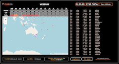
CLICK HERE for VK3BVW Live Stream (Clublog)
| QRZ callsign lookup: |
© Rob Wagner, Mount Evelyn DX Report, and contributors 2012-2027


Comments
Post a Comment
Comments are moderated and may not appear immediately. If your comment isn’t visible right away, it has been received and will be published shortly.